 |
 |
Regional Netwok Analysis
Regional Network Analysis |
|
|
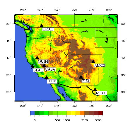
The chosen regional GPS network consists of seven stations of the International GPS Service (IGS) plus the station SLAC M40. The figure below shows the geographical distribution of all eight sites. |
|
The stations are referenced by the IERS/IGS 4-character site code of their DOMES numbers. SLAC is not an official site name. The official sites are:
|
|
The performance of the IGS stations may be viewed at the Continuous GPS Global Network Station Performance site of the Jet Propulsion Laboratory (JPL). The same institution provides long-term (several years) coordinate time series. |
|
A detailed description of the processing steps being performed to derive accurate coordinates for SLAC M40 are beyond the scope of this web page. It should suffice to give an outline of the steps involved in the following itemized list: |
|
|
The GPS observation files are exchanged in the Receiver INdependent EXchange format (RINEX). ERP files contain the Earth orientation parameters (pole coordinates, UT1-UTC, UTC-GPStime). |
|
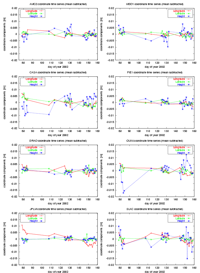
The following time series plots show the variation of the coordinate components of all 8 stations over the 19 days that were used to determine the currently valid ITRF2000 coordinate triplet. |

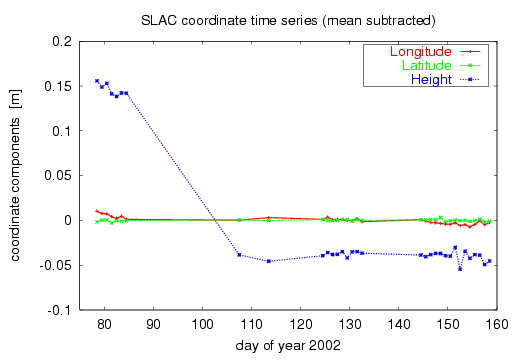
Coordinate Time Series for SLAC M40 |
|
|
Coordinate time series for the station SLAC M40 derived from all daily observation sessions processed so far. Only one mean value was subtracted, i.e., the change in the antenna mount is still contained in (mainly) the height component and clearly shows up as a jump of about 20 cm. |
|
Coordinate time series for all stations as determined from 33 daily observation sessions. The station velocities are not accounted for. The change of antenna mount with SLAC M40 is considered by introducing two mean values. |
RINEX files for SLAC M40 |
|
|
Please feel free to download the RINEX observation files of the station SLAC M40. RINEX is the Receiver INdependent EXchange format that is being used for the transfer of GPS data between different platforms and software packages. It is an ASCII format and is currently used in Version 2.10. |