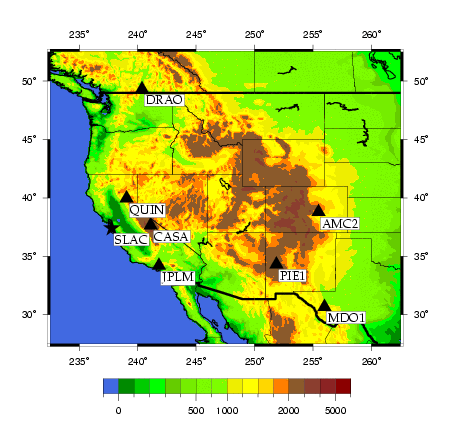
Regional Network AnalysisThe chosen regional GPS network consists of seven stations of the International GPS Service (IGS) plus the station SLAC M40. The figure below shows the geographical distribution of all eight sites.
The stations are referenced by the IERS/IGS 4-character site code of their DOMES numbers. The official sites are:
The performance of the IGS stations may be viewed at the Continuous GPS Global Network Station Performance site of the Jet Propulsion Laboratory (JPL). The same institution provides long-term (several years) coordinate time series. Here is a concise outline of the processing steps being preformed to derive accurate coordinates for SLAC M40:
The GPS observation files are exchanged in the Receiver INdependent EXchange format (RINEX). ERP files contain the Earth orientation parameters (pole coordinates, UT1-UTC, UTC-GPStime). |