 |
 |
Master Control Station
Description of the Master Control Station SLAC M40 |
|
|
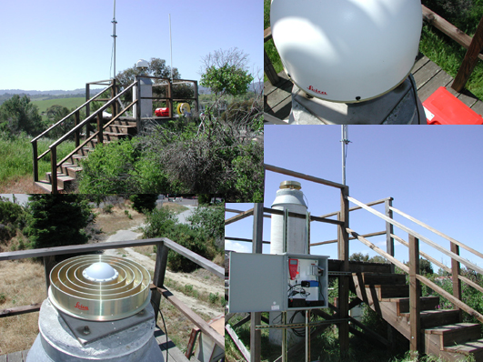
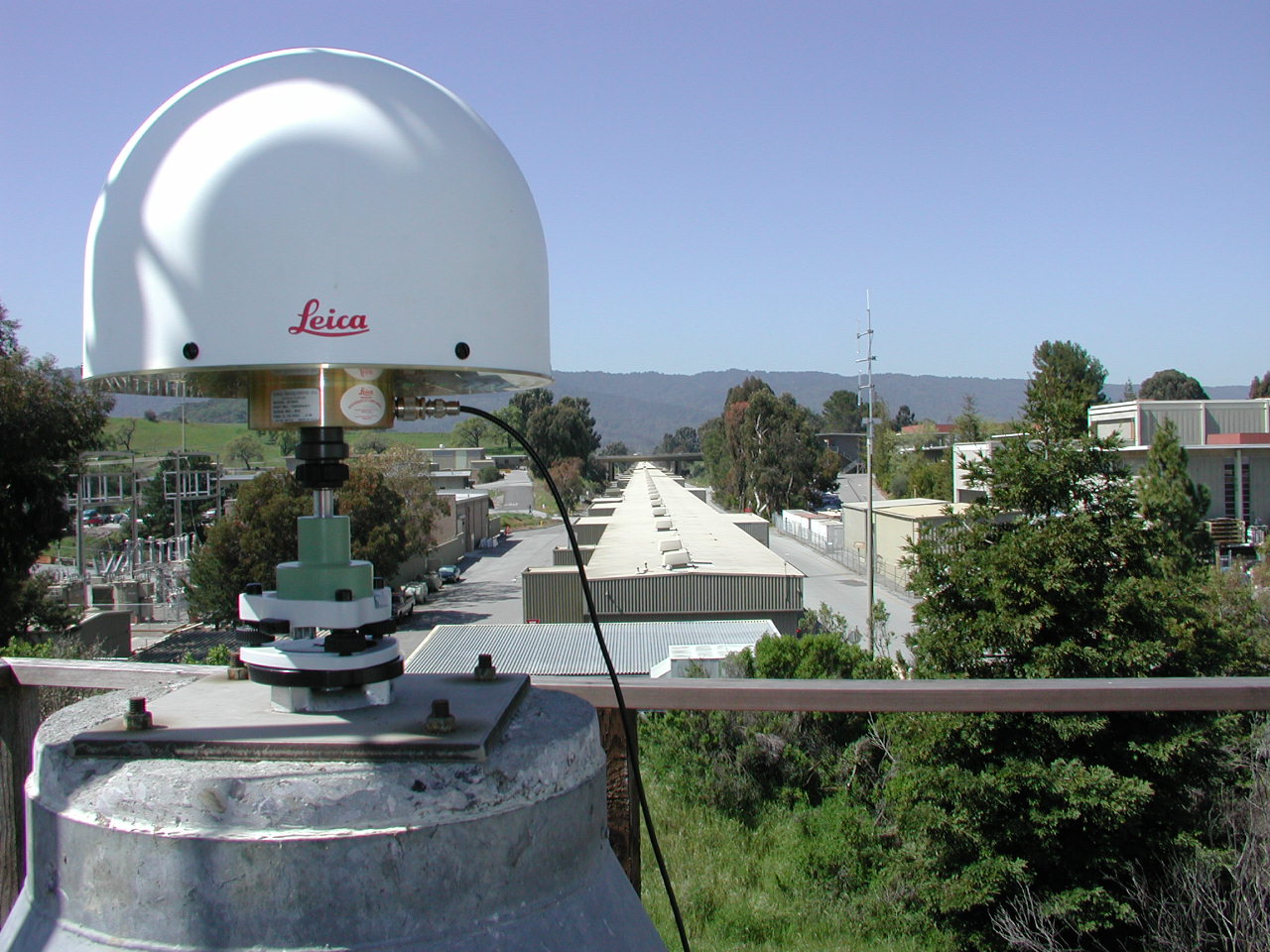
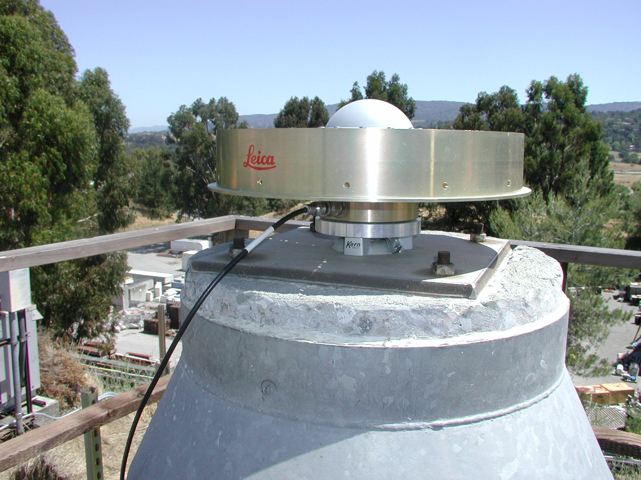
Located next to the Sector 30 gate at the end of the linac is SLAC’s newly designated GPS master control station known as SLAC M40. The actual control point is located on top of a 60 cm diameter concrete pillar with the top about 3 m off the ground. A wooden deck surrounding the concrete cylinder provides access. The actual receiver is a Leica System RS 500 Receiver that is housed in a weatherproof box attached to the deck. The AT-504 choke ring antenna is attached to the top of the pillar using a Kern forced centering mount. To protect the instruments from lightening, a lightening arrester is installed at M40. |
|
This control monument was chosen for several reasons: |
|
- Central SLAC location |
||
|
- Monument within controlled area of SLAC | ||
|
- Amount of visible sky is large enabling better GPS geometry | ||
|
- RTK radio-modem coverage of SLAC nearly perfect | ||
|
- Permanent power access and potential network connectivity | ||
|
- Easy access for monitoring the equipment | ||
|
- Pillar and deck are in good condition |
History of GPS Operations at SLAC |
|
|
|
Data Flow |
|
|
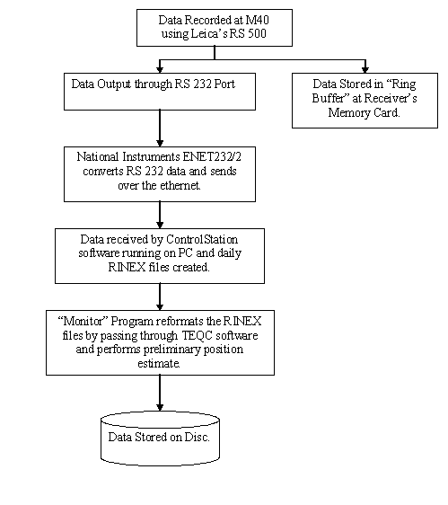
The GPS data is recorded using Leica's RS 500 receiver. The following diagram represents the flow of data from the receiver to the final storage | |
 | |
| Presentation after the new phase of installation at M40. |
Official Coordinates for SLAC M40 |
|
|
The official coordinates of the Master Control Station refer to the Antenna Reference Point (ARP) of the LEICA AT-504 GPS antenna. The ARP is located at the bottom of the preamplifier as indicated in the antenna diagram: LEIAT504
+-------+ <-- 0.1393
/ + \ <-- 0.1282 L2
| + | <-- 0.1093 L1
+-----------------+-------------+------------------+ <-- 0.1020 TCR
| |
| |
| |
| |
+-+--------------------------------------------------+-+ <-- 0.0380
+-------------------+-------------+--------------------+ <-- 0.0350 BCR
| |
| |
+------x------+ <-- 0.000 BPA=ARP
<-- 0.3794 -->
ARP: Antenna Reference Point
L1 : L1 Phase Center L2 : L2 Phase Center
TCR: Top of Chokering BCR: Bottom of Chokering
TGP: Top of Ground Plane BGP: Bottom of Ground Plane
TPA: Top of Preamplifier BPA: Bottom of Preamplifier
TOP: Top of Pole
All dimensions are in meters.
| |
|
The coordinates are geocentric XYZ triplets in the International Terrestrial Reference Frame 2000 (ITRF2000) geodetic datum as provided by the International Earth Rotation Service (IERS). They are updated on an as-needed basis. | |
| Validity | Epoch | X [m] | Y [m] | Z [m] | Comments |
| ... to 31-03-2002 | 2002.22 | -2703115.949 | -4291767.428 | 3854247.948 | old mount |
| 01-04-2002 to ... | 2002.36 | -2703115.873 | -4291767.294 | 3854247.829 | new mount |
|
The current coordinates are also available in different datum definitions and with other representations. |
| Type | Coordinate triplets for SLAC M40 | Datum | ||
| XYZ | -2703115.873 m | -4291767.294 m | 3854247.829 m | ITRF2000 |
| φ λ h | 37° 24' 59.45827" | -122° 12' 15.33968" | 63.687 m | |
| XYZ | -2703115.209 m | -4291768.558 m | 3854247.785 m | NAD83 |
| φ λ h | 37° 24' 59.44305" | -122° 12' 15.28945" | 64.228 m | |
| NEH | 603088.729 m | 1849150.037 m | 96.740 m | |