A GIS Study for the Alignment Engineering Group (Obsolete Website)
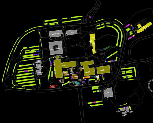
A Geographic Information System (GIS) was studied and developed to test an efficient means to maintain and retrieve the large amounts for new and stored surveying data. A test GIS for the AEG was created using Bentley's MicroStation Geographics. It is based on the MicroStation CAD platform. The example to the left shows the results of a thematic query on building types from the test GIS. Known as AEGis, this GIS was focused on a limited region of SLAC. It served as a base-map and was an accurate 2D representation of the site. All important features such as buildings and survey monuments were measured by site surveys. (Magnet and similar data is planned for the GIS in the future.) A detailed report, poster summary and progress reports are presented below.
|